Ashley Gold acquires additional claims at Tabor with historical sample of 33g/t Au*
Ashley Gold Announces Resignation of George Stephenson Ashley Gold Corp. (CSE: “ASHL”) (“Ashley” or the “Company”) announces the resignation of

Kenora Mining District
Au-Ag
Advanced Stage – Targets Identified
100% Ashley Gold Corp
1,000 HA
Shear hosted Quartz Veins
Ashley Gold Corp
Drill program pending financing
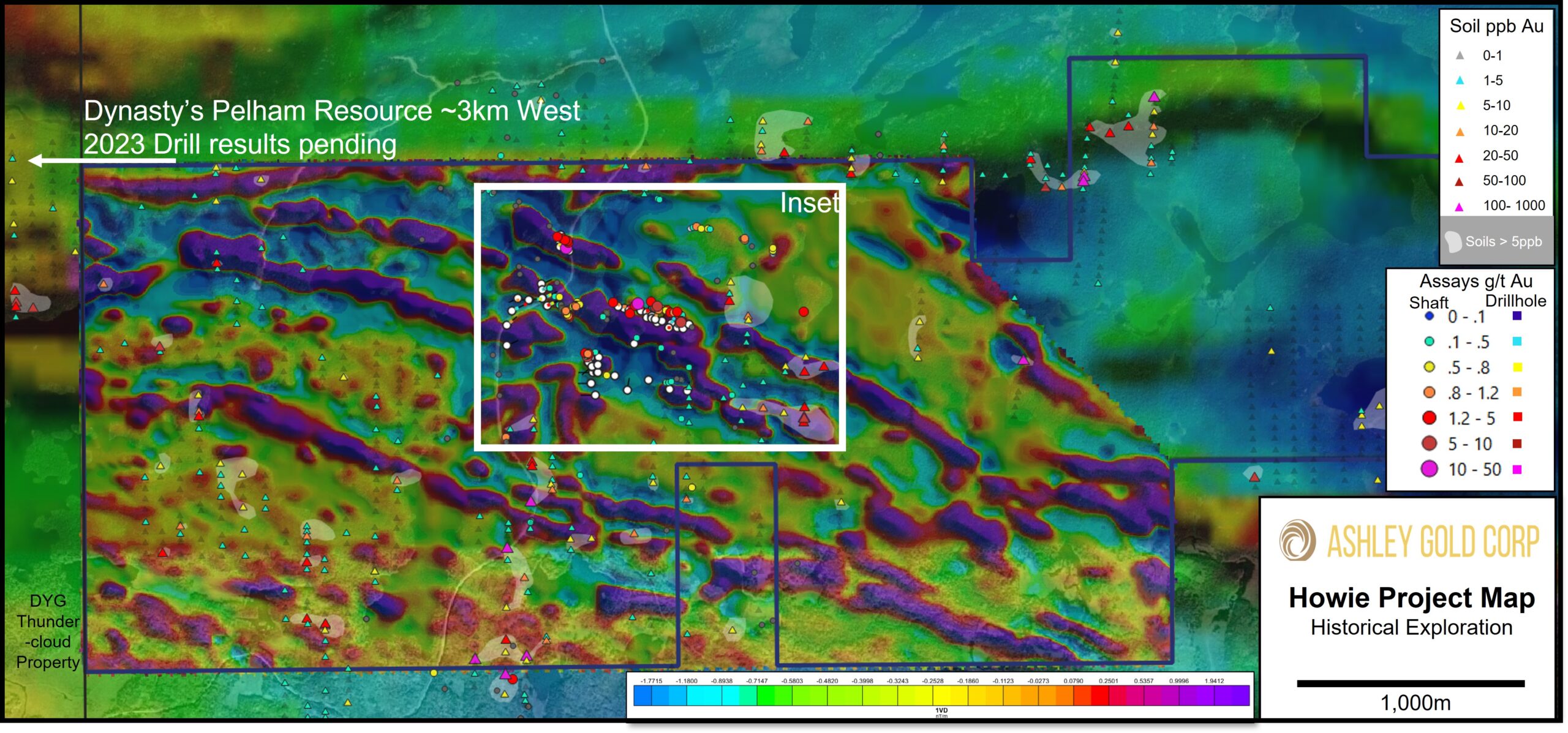
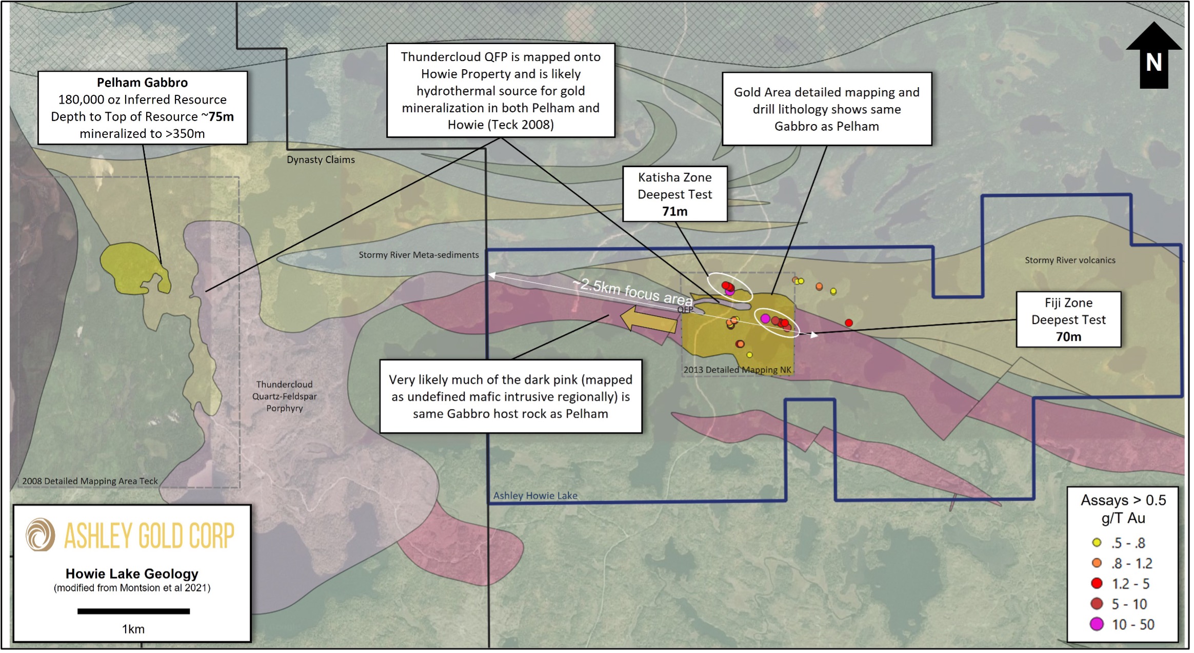
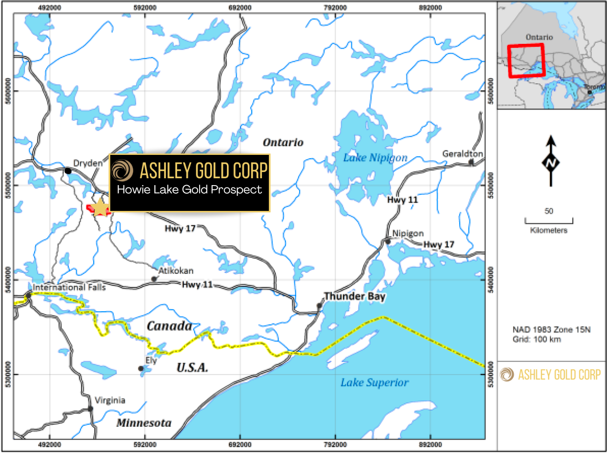
Ashley Gold Corp acquired 64 mining claims over approximately 1000 Ha just south of Ashley’s Tabor Lake Mine Project. The Howie Lake claims share a common boundary with the Thundercloud Lake (Pelham Project) that is currently operated by Dynasty Gold and hosts a defined resource of 180,000 oz Au.
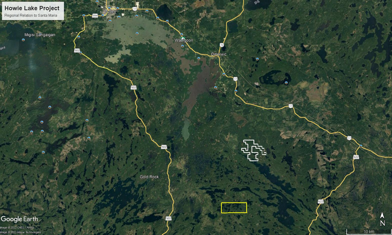
The Howie Lake Property is located 55 km to the southeast of Dryden, Ontario. The property can be accessed through a year-round gravel road that leads south of Trans-Canada Highway #17, the main access road from Thunder Bay, Ontario.
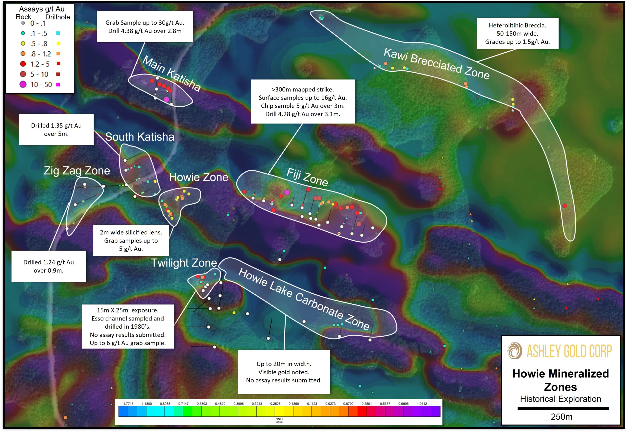
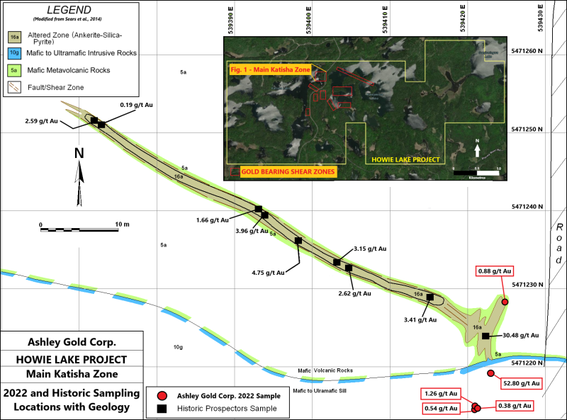
The reconnaissance program consisted of prospecting and sampling along the road-cut area of the Main Katisha Shear Zone; one of the nine known gold occurrences within the Project bounds, located on the north end of the Howie Lake Project. The program was undertaken to verify historic sample results and test the gold prospectivity of the area. A total of 5 surface channel and chip samples were collected along the road exposure of the Main Katisha Zone. Gold values ranged from 0.381 g/t Au up to 52.80 g/t Au with an average aggregate grade of 11.17 g/t Au across a strike length of approximately 16 metres
Shear Zone System Highlights
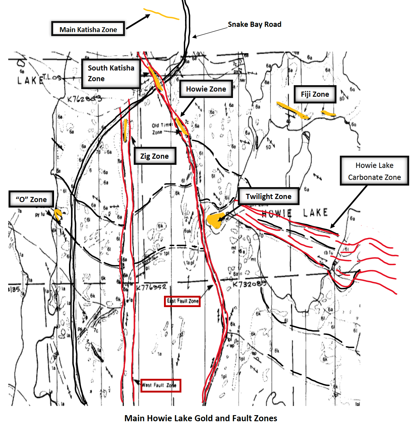
Main Katisha
South Katisha
Howie Zone
Fiji Zone
Twilight Zone
Howie Lake Carbonate Zone
Kawie Brecciated Zone
Zig Zag Zone
The Howie Property has several known historical mineralized zones sampled at surface and, in some cases, drilled. Generally, the mineralization is structurally controlled within or adjacent to shear zones. Thundercloud-type porphyry intrusive dykes have been identified at surface and in drill holes.
Esso performed two drilling campaigns in 1986 and 1987 before they exited the mineral exploration space and focussed on oil and gas production. Year-round access is excellent with a main forest service road running through many of the mineralized zones.
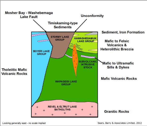
The claim group is underlain by two stratigraphic groups of supracrustal rocks: the Wapageisi Lake group, and the Stormy Lake group. The metavolcanics of the Wapageisi Lake group comprise a thick sequence of pillowed, mafic volcanics of tholeiitic affinity with thin intercalated horizons of intermediate to felsic calc-alkaline flows and associated interflow sediments (chert/argillite). The sequence is capped by a thick (> 1 km) sequence of mafic to felsic pyroclastic breccia. Unconformably overlying the Wapageisi Lake group is the Stormy Lake group which consists of a thick {3000 m) succession of polymictic and volcanic conglomerates with thin intercalated rhyolite and basaltic flow horizons.
Ashley Gold Announces Resignation of George Stephenson Ashley Gold Corp. (CSE: “ASHL”) (“Ashley” or the “Company”) announces the resignation of
Ashley Gold Kicks off Induced Polarization Survey and Defines Burnthut Drill Locations Ashley Gold Corp. (CSE: “ASHL”) (“Ashley” or the
Ashley Gold Samples 26 g/t Au in Start of 2024 Exploration Program at Howie Ashley Gold Corp. (CSE: “ASHL”) (“Ashley”
Ashley Gold Receives Howie Exploration Permit and Ontario Junior Exploration Program Funding Ashley Gold Corp. (CSE: “ASHL”) (“Ashley” or the
Ashley Gold Announces Financing for Spring Exploration Ashley Gold Corp. (CSE: “ASHL”) (“Ashley” or the “Company”) announces a non-brokered private
Ashley Gold Outlines Spring 2024 Exploration Program Ashley Gold Corp. (CSE: “ASHL”) (“Ashley” or the “Company”) is pleased to provide